Return to Colchuck Lake, July 27, 2019

This is my third time blogging about this hike, so I obviously like it. It is a good hike to go to when it is raining in other areas as Leavenworth is on the other side of the mountains and can be sunny when it is rainy elsewhere. Today, we avoided the rain in the North Cascades and found the sun at Colchuck Lake. Apparently everyone else had the same idea. It was very crowded. So crowded, that I am not sure I would revisit this trail on the weekend again. We arrived around 9:45 am and parked about a half mile from the trailhead on the road. I guess everyone else was seeking the sunshine too.

Stats per WTA:

Distance: 8 miles round trip, Elevation gain 2280, high point 5580 ft.

Pass needed: NW Forest Pass

WTA Link for more info and driving directions: https://www.wta.org/go-hiking/hikes/colchuck-lake

Group size limit for this area is 8 people. Dogs are not allowed on this trail, so leave your furry friends at home. If you want to camp overnight, overnight stays are by permit only and is strictly enforced as this is part of the Enchantments core zone.

The hike begins on the Stuart Lake trailhead, climbing gently through the forest. Enjoy this shade if it is a hot day as this trail can get very warm. This trail is what encouraged me to buy a water filter. On my first hike up, I ran out of water due to the heat, elevation and dry air.  After a mile and a half you will have your fist bridge crossing over mountaineer creek. Stop to enjoy the cool air here and take some photos.

After the crossing the trail becomes steeper and rockier, and will continue to get more rocky and steep on the second half of the trail. This portion reminds me a lot of hiking in the Sierras. You will also start seeing some mountain views in this section of the trail. When you stop to catch your breath, don’t forget to look up/stop to let others pass.

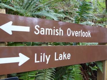
In three quarters of a mile, you will come to a junction, keep your head up, as the sign is a little high. At this junction you turn Left to continue to Colchuck Lake. If you want an easier hike, continue straight to Stuart Lake, which is also a very nice destination. Immediately after this turn is another bridge crossing over Mountaineer Creek. This one has some tricky footing, so watch your step. Also, stop to enjoy the view of a big rock slide section with great peak views. Shortly after this crossing there is a spot where you can easily access the creek to filter water, wet a hanky to cool down or take a break.

From here the trail climbs upward with rocky and rooty steps. As you climb, more mountain views will open up. Take the time to stop and appreciate the scenery. There is one spot along the way with a large granite slab with sweeping views. This is a great spot to stop and have a snack and drink some water before the final climb to the lake.

After your break, make the final climb to the lake. You will see a huge rock to your left that reminds me of a whale. When you see that rock, you are almost there. Don’t give up! Once you enter the basin, you will have amazing views of Colchuck Lake, Dragontail Peak, Aasgard Pass and Colchuck peak. As you round the lake to the right, you will come upon a large granite slab that is great for picture taking. From here, search for a lunch spot. We continued on the trail around the lake and over a peninsula, comin upon a nice tarn next to Colchuck. This tarn was less crowded, and was a great swimming place as it was warmer than its neighbor. I took the time to enjoy a dip in the lake while those with me enjoyed a rest and had lunch.

When you head back down the trail after lunching and relaxing take your time on the rocky section going down. You will be tired and “over the rocks” just be careful and get down safely. Once you are back past the second bridge you can relax a little and enjoy a smoother trail back to the lot.

Skyline Divide, July 20, 2019

Well, it has been a long time since I have written a post! I just purchased a new camera, so I decided it was time for me to add a blog post.

Last weekend I went to Skyline Divide with a few friends. We had a perfect day for it, sunny not to hot, a little buggy…but it could have been worse.

There were many backpackers camping along the way. I imagine the sunsets and sunrises are amazing up there if you have clear skies. There are a couple of things to be aware of if backpacking this trail. First, no water sources. You have to carry all of your water up. Second, all visitors must pack out (not bury) human waste. They did have some blue bags at the trailhead. It looks like there are two designated camping places (see WTA for more info or contact a local ranger station) however, it seemed many were just camping on the ridge line.

P1000001_B

To get to the trail, take the Mount Baker Hwy (SR-542) east for 34 miles to the Glacier Public Service Center. Reset your odometer, and watch carefully for the junction with FR-39 (Glacier Creek Road), just 0.8 miles down the road and to the right. Immediately after the intersection with FR-39, follow the signs to the Skyline Divide Trail and turn left on FR-37. Continue for 12.9 miles until the trailhead. Caution! the road was very potholed in the beginning portion and rocky and narrow in other parts with several blind turns. Some sedans did make it up fine…even a Honda Fit was there, but I would recommend an SUV. It is also a good idea to visit the bathrooms at the ranger station before heading up this bumpy road. The parking lot was pretty full when we arrived at 9:30. I recommend getting an early start to grab parking. If staying overnight, you might be able to show up later…after some of the day hikers have left.

Hiking stats per WTA:

Distance: 9 miles round trip if you go to all of the knolls (we did about 8.25 round trip)

Gain: 2500 Feet (this is a bit deceiving because there are a lot of ups and downs over the knolls.)

High point: 6563 feet (according to GAIA we got to about 6463 feet) and gained 2388

Parking pass needed: Northwest Forest Pass

For more trail info see: https://www.wta.org/go-hiking/hikes/skyline-divide

The trail starts out at climbing, it gains 1500 feet in two miles. Nothing like a good climb to get your heart pumping and to warm you up! Luckily this part of the climb is mostly through the forest, so it is shaded. When you get near the tree line, the trail opens up to wildflower fields and some peek-a-boo views of Mt. Baker and other peaks. This is just a teaser. We were a little late for some of the flowers, but there was a lot of lupine!


You will eventually make it out of the trees on the first knoll with a WOW look there is Baker view. I think if we were a little earlier there would have been more variety of flowers here too. Baker will be to the South and Shuksan will be to the east. You will come to a fork in the trail, the trail that that goes to the left leads to potential campsites, continue right and enter the Mount Baker Wilderness. At this point you have gone 2 miles.


According to WTA, continue 2.5 more miles on the “gently rolling” ridge line over a series of five more knolls. I thought some of these “gently rolling” parts were a bit steep, but short. On the second knoll you have an option to take the fork to the left over a steep trail or go around the knoll. I recommend saving your energy and going around it to the right. WTA says there is a similar option at the 3rd knoll, but I don’t recall seeing it. As you continue to move southward the views keep getting better, it is worth the effort to go farther.


At the fourth knoll, 3.5 miles from the trailhead, there is another split in the trail. The trail to the left goes to campsites a mile away near Deadhorse Creek in the valley below. Continue on the trail to the right, to climb the spines of the 5th and 6th Knolls. There is a little bit of a scrable at the bottom of the 5th knoll but it is short, and there are some big drop offs with views of the valley below. As you continue the views of Baker and surrounding mountains keep getting better and better.


Two of us opted to continue. We reached the 6th knoll and I debated going up, it was steep and a bit of loose scree…but I said, “If we go part way, I am most likely to make it to the top.” I am glad I made the effort! Great 360 degree views! If the others were not waiting on us, I would have been tempted to go a little farther as it did not look too hard to get to the next big viewpoint. However, we decided to make this our end point for the day.


On the way back you will be saying…”I think this is the last knoll, the last uphill” and you will be wrong. There will be one more. Next time…to the next viewpoint!

Orcas Island Adventure, May 19-20th

Over the weekend of May 19th through 20th I did a girls weekend on Orcas Island with some hiking buddies. Our goal was to hike Mount Constitution.

We took the ferry from Anacortes (make ferry reservations early) with the intention of hiking Mt. Constitution on Saturday, then possibly doing another hike on Sunday before returning home. After our ferry crossing, lunch, and trying to rally the troops, we arrived at the trail a little too late to do the hike. We opted for a nice easy hike around Mountain Lake instead. This lake would have been very nice for swimming, which I will remember if I return. I think the loop around the lake was about 4 miles, and it was rolling up and down but not too much elevation gain. It was a nice way to spend the afternoon.

Since we didn’t have enough time to hike up Mt. Constitution we drove up it to catch the view…and returned the next day to hike it. We were uncertain if it would be cloudy in the morning, so we took the opportunity while we had it.

For lodging we stayed at the Golden Tree Hostel located in the East sound area of Orcas Island. It was very charming. The artwork and tchotchkes reminded me of my mom and dad and their funky style. We booked a dorm room with 7 beds, but they also have private rooms. In addition, they have a geodome you can stay in, teepees, tent sites and a bus. One thing to make note of is everything in town closes early, so if you want to go to the grocery store or get a bite to eat, do it early. If staying in the hostel, I recommend packing food to bring with you and cook it there. The hostel was walking distance to town and it was affordable.

The next morning we returned to the Mount Constitution trail and set out to hike the loop trail that went up near the road and came back down via the twin lakes trail. This is about a 6.7 mile hike with 1500 feet elevation gain. The trail starts near the campground by Mountain Lake. It climbs steeply at first and almost feels relentless. Once you get to Little Summit the grade eases a bit and you start seeing views of the San Juans and Puget Sound. We ended up having another nice view from the top even though it was partly cloudy.

On the trail up we saw very few people. On the other side of the loop there were more people coming up. I am not sure if this is just a more popular trail or if it had to do with ferry times and people making their way to the island. We made a quick stop at twin lakes before heading back to the trailhead at Mountain Lake.

We caught the afternoon ferry back to Seattle which was also a very nice ride. Don’t forget when booking your ferry to make it a round trip fare.

Return to East Bank Baker Lake, May 12, 2018

I liked Baker Lake so much that I decided that I needed to return to the north side on a Sunny day. I had to see the mountain views and sun streaming through the trees. Don’t get me wrong, it was nice in the rain…but better in the sun.

The road was still pretty bumpy especially near the end, but there were sedans that make it. As always, I was happy to give gas money to someone with a SUV.

Here are the stats again just in case you missed it in my earlier post:

From the north end of the lake:

9 miles round trip, 500 feet gain (net), high point 1,000 feet

Parking pass required: NW forest pass

For more info and directions see: wta.org/go-hiking/hikes/baker-lake

The trail starts out on a wide path and eventually comes to a swing bridge. I have to say I was disappointed that this bridge was not more exciting. It was very sturdy and not too bouncy. I did make a point of going out to the middle of it on the way back and jumped up and down just for fun. The WTA description makes it sound much more exciting than it was. The views from the bridge were much more impressive on a sunny day. Look! there is a mountain back there!

As you continue on the path you cross another bridge of Blum Creek – look another mountain peak that was hiding!East Bank Baker LakeAs pictured in my earlier posting you come across some impressive trees and boulders. Stop to give thanks to the trees and enjoy the little hiding spots in the boulders as you wander down the trail. There were still some spring flowers blooming along the way as well. Quite a few of bleeding hearts, a few trillium holding out…and some others that were unidentified.

Oh and…..there were still many creeks and a lot of water. The one creek crossing was still a little tricky, poles are helpful on the slippery rocks.

The one big thing that I missed last time on this portion of the trail was the views of Mount Baker. Be patient, it takes a while to get to them, but they are pretty great.

Since we weren’t cold and wet, we carried on up Noisy Creek in search of “Big Doug,” one of the largest fir trees in the cascades. We found it! We also checked out Noisy creek on the way back down.

One of these days I would like to do a backpack here. It would be a great beginner backpacking trip. Who is in?


Ancient Lakes, Saturday, May 5th 2018

On Cinco de Mayo I went to Ancient Lakes in Eastern Washington for some sunshine and hiking with meetup. This is a great place to go in the spring when it is gloomy and rainy in Seattle, as it is often sunny on the other side of the pass.Ancient Lakes

There are two trailheads, we went to the “backpacking” entrance. The day hike trailhead has a steep descent next to a waterfall over some talus rock. If you want to take the easier way in take the following directions:

“For the backpacking trailhead, you need to enter from the west. Similar to the day hiking entrance, you head north along 281 and turn west onto White Trail Road. However, instead of turning off to the fishing area, continue on White Trail Road. The road swings north after about four miles, and you continue about another 3.5 miles (approximately) until you turn left (west) on Rd 9 NW. After about two miles, the road swings south and turns into Ancient Lake Rd NW. Head south on here about four miles until you reach the trailhead.”  The road was in good shape. My Honda fit would have made it with no issues.

The stats on this trail can vary as there are many routes you can take. Here are the stats per WTA:

12 miles round trip, 625 feet gain, highest point 1200 feet.

Parking Pass required: Discover Pass

For more info and directions see: wta.org/go-hiking/hikes/ancient-lakes

Ancient Lakes has beautiful mesas, coulees and waterfalls. In the spring, you can also catch some spring flowers. If backpacking, do not drink the water even if it is filtered, much of the water is irrigation runoff and it is not safe to drink. Also, watch out for rattlesnakes and ticks. We were warned that the rattlesnakes were out on the trail on the day we went, and we did see one cross the trail. It is best not to go off trail into the sagebrush just in case one is hiding under a rock, etc.

From the backpacking parking, we followed the trail to the left around to the lakes. You can make this a loop hike around the lakes, which allows you to get different perspective on the scenery along the way.

We continued around the loop around some of the lakes. Some of the lakes had some nice trees and bird life…and snakes around them. Eventually you come to a steep side trail that goes up to the top of the mesa. Part of our group went up, but I chickened out because I was concerned about coming back down the steep talus. Apparently they saw a marmot and Dusty lake on the other side. The little group that stayed spotted some hawks and magpies nesting in the hillside.

Along the loop on the way back there were some interesting rock formations carved by water. Take some time to ponder these and how they were formed.

It did end up getting pretty hot by the end of our hike. Make sure you bring lots of sunscreen and water and get an early start. It is amazing what a different landscape we have on the other side of the mountains. Beautiful.

East Bank Baker Lake – Round 1 in the Rain, April 28, 2018

I wanted to go back to Baker Lake to check out the north end. My friend Jerry and I decided to brave the rain and set out on this trail at the end of April. The trail is similar to the other side, a lot of huge trees, creeks and moss. I was sad to miss the mountain views on this particular outing but it was good to be outside.

Here are the stats for the north side of Baker Lake per WTA:

9 miles roundtrip, 500 feet gain, high point 1,000 feet.

Pass required: NW forest pass or America the Beautiful Pass

I believe the gain listed is net gain. This trail has a lot of ups and downs all short, but they add up. This side of the trail did have more switchbacks than the south side.

For driving directions and more trail information go to wta.org/go-hiking/hikes/baker-lake

The road is paved until the last 6 miles. The dirt section was okay in the first portion, then had several potholes as you near the trailhead. Again, there were some cars with lower clearance, so you can make it with care.

The trail begins along Baker river on a wide dirt trail. Enjoy some of the big trees around you as you approach a suspension bridge that crosses the river. I was thinking this bridge was going to be much more exciting than it was. It was very sturdy and wide and not too bouncy, piece of cake.

After crossing this bridge, the path crosses another creek which used to be an old river channel (Blum Creek), on the first of many other bridges. As you go up the trail, check out the cool mossy boulders in the next section.

The next cool bridge is at Hidden Creek, it is built in a zig-zag across this beautiful waterfall.

There were two stream crossings that did not have bridges that were a little tricky. The water was slightly high and the rocks are slippery. Poles are recommended for these crossings. Take your time and watch your footing and you should be fine. (Sorry for the water dots on some of the pictures from here on out… darn rain!)

There are several old growth trees along this trail, don’t forget to stop and pay them some respect. Give them a hug if so inclined.

On a sunny day, you will start to see mountain views peaking through the trees as you hike along the shoreline. We didn’t have these views on our soggy outing, but we did enjoy the mossy forest. There were also some trillium dotting the trail along with bleeding heart, yellow violets and salmonberry. We even caught sight of a Rufus humming bird along the trail.

At 4.2 miles you will come to a signed intersection you can head up Noisy Creek in search of a large fir tree named “Big Doug”, continue down the trail as a through hike, or go to the Noisy Creek campground for lunch…and a potential mountain view. We had lunch at the campground and then went in search of Big Doug. The trail up to this old fir tree is pretty steep and with wet conditions we gave up…little did we know we were almost there.

Noisy creek campsite was another nice spot, big sites, picnic tables, bear lockers and an alfresco camping toilet. There is one more camp site between Noisy Creek and Maple Grove that I am told is pretty nice. I would love to try this as an easy backpack.

On the way back a couple of the mountains were trying to peek behind the clouds, but no full views on this day…an excuse to come back.

Oyster Dome, April 27 2018

It was supposed to be a sunny day on Oyster dome on this day, so a couple of friends and I took the day off and went for a hike. Unfortunately, it was socked in with fog. It was still nice to get outside and to get a hike in.

Here are the stats for Oyster Dome Per WTA. I am not sure that our hiking distance followed these stats as we did a loop rather than the out and back. The loop is apparently a little longer, but slightly easier than the other option.

5 miles round trip, 1050 feet gain, high point 2025 feet.

Pass required: Discover Pass

For driving directions and more trail information please see wta.org/go-hiking/hikes/oyster-dome

We started from Samish Overlook trail, and took the trailhead to the left of the bathroom towards Lily Lake. The road up was a little rough, but you could probably make it up with a sedan with care. There are a couple of turns to look for on this route. At the first split, head left uphill towards Lily Lake.  P1020949

From this point, keep climbing until you reach the next split near the lake. Take a left here, where they have conveniently placed a map so you can get your bearings. Go a short distance, then follow the signs to Oyster Dome.

You will come upon another split in the trail, which either leads back to the trailhead (this is the way to go on the way down) or up to Oyster dome. Keep on going until you get to the viewpoint.

We had some spots of sunlight and spots of fog on the way up which made an interesting canvas for photos.

The middle section when you reach the second turn at Lily Lake was a bit swampy (but not muddy on the trail). There was quite a bit of skunk cabbage, no bugs while we were there, but I could see this part getting buggy when it is warmer.

Finally the view at the top, or lack there-of. We will have to come another day to see catch the view of the Puget Sound/San Juans. Here are my lovely hiking buddies.

Oyster Dome

Sorry Per, I didn’t Photoshop in what we were missing!

Going down, do a loop and follow the signs back to Samish Overlook. Don’t go all the way to Chukanut Drive in error or you will have a long walk back!

Baker Lake – Maple Grove, April 22, 2018

What a beautiful hike!!! It helped that we had a perfect day to do it. This nice easy hike is just what the doctor ordered after doing a harder hike the day before. This trail can be done as a through hike to the East Bank Baker Lake trailhead or as an out and back to the Maple Grove campground. We did the out and back which is 8 miles round-trip. The through hike is about 14 miles.

Stats per WTA:Baker Lake - Maple Grove

8 miles roundtrip, 500 feet gain, High point 1,000 feet.

Pass required: NW Forest Pass (or America the Beautiful Pass)

This is trail starts at the south end of the East side of Baker Lake for more info and directions see: www.wta.org/go-hiking/hikes/baker-lake-maple-grove

In driving to the trailhead, check out the cool waterfall when going over the dam. Sorry, I did not get a picture, but it was very nice. Per WTA, this lake was created in 1959 when the Baker River was dammed. After the dam, the road is unpaved. The lower part was in good shape, the upper part had more potholes. There was one sedan at the parking lot, so you may not need an SUV to get there.

The trail starts in the forest. SOOOOO pretty! Very mossy, enormous old growth trees, streams everywhere most had bridges, those that didn’t were easily passable on the day we went. Mother nature at her best.

There were also a few flowers dotting the trail. My favorite spring flower, trillium dotted the trail here and there as well as some yellow lilies.

After the first forested area you will come along spots where you can see mountain views peaking between the trees. You will be up for a real treat with full mountain views of Mount Baker, Mount Shuksan and surrounding peaks. I highly recommend doing this trail on a sunny day so you get these mountain views, but even in the rain the trail is beautiful.

You will eventually come across the first campground, Anderson Campground. I thought this was the nicer of the two campgrounds on this section of the trail. The camp spots were smaller and it had a camp toilet (not a vault toilet), the sites were out on a peninsula with awesome views of the mountains. All of the campsites on this trail had bear lockers so there is no need to hang your food. This would be a great first backpack. Take a brief stop here and continue down the trail to Maple Grove Campground.

On the way to Maple Grove enjoy more of the mossy forest, and mountain views peeking through the trees, and of course more creeks. There were a couple of blow-downs along the way, but nothing impassable.

Maple Grove campground is a larger campground. It has a vault toilet, fire rings, picnic tables and a vault toilet. The sites themselves are bigger than Anderson Point. It also has awesome views.

From here, you can either do the through hike or make this your turn-around point. Or spend the night. Happy Hiking!

Return to Sauer’s Mountain, April 21, 2018

It was raining in Seattle, so a couple of friends and I headed over to Leavenworth to hike up Sauer’s Mountain. We did this a little later in the spring last year and the flowers were out a bit more, but we were certainly not disappointed.

This hike is technically in Peshastin, just outside of Leavenworth…but close enough. The WTA directions are missing the turn off from the main road, which I believe was main street.  From the turn, you will go over the bridge…then follow WTA directions. This trail is built partially on private land by Mr. Sauer. Be respectful of the land owner and his neighbors! There was recently and off leash dogs that killed one of his chickens (a beloved pet) and he was thinking about closing the trail indefinitely. For use of his trail Mr. Sauer takes either a cash donation for parking/trail use or you can buy a bottle of wine made at his son’s winery.

Here are the stats per WTA:

6 miles round trip, 2,000 feet gain, high point 3116 ft.

On the first section of the trail Mr. Sauer has put up a variety of art pieces to enjoy. Here are a few of them. I think I took better pictures of others in my previous blog post.

There was one point, where I realized we made a wrong turn and took the wrong trail up, but it joined with the main trail. there will be two turns to the right, skip the first one and take the second one. Enjoy the balsamroot, lupine and other flowers on the way up. This year the Lupine was not blooming yet, but will be soon. Also, don’t forget to look up! Check out the view behind you.

You will eventually leave the open trail and will be under the tree cover. We were lucky to catch some lilies and more balsamroot blooming in this area.

You will eventually come to a ridge that you will keep climbing up to the summit. Here you will have views of Granite Mountain as well as other peaks. Again we were treated to some spring lilies (glacier lilies).

After this there is one more steep push up. Almost there! At the viewpoint there is a sign that points out the different peaks. The trail continues from this point. There used to be a cool cairn up the trail but it is gone. I recommend just stopping at the signed view-point.

When you come down, you can go back the way you came OR you can do a loop. At the one mile point you will see a sign. Turn right here to do the loop. On this trail you get a river view which is nice.

Then make your way back to the start…don’t forget to tip Mr. Sauer for use of his trail.

Ebey’s Landing, March 31, 2018

We had a nice sunny day at the end of March so a few friends and I ventured to Whidbey Island to hike Ebey’s Landing. This hike is so beautiful and different from most other hikes I have done as it is a coastal bluff hike. To get here you can either take the ferry over from Mukilteo to Clinton or drive around via Anacortes over Deception Pass. We took the ferry over. If you decide to drive around, you might consider doing a bonus hike at Deception Pass. The Ebey’s landing hike is pretty easy and not very long, so this might be a nice way to make a day of it.

Here are the stats per WTA:

5.6 miles round trip, gain 260 feet, high point 260 feet.

Parking Pass: Discover Pass.

For more info and directions see: www.wta.org/go-hiking/hikes/ebeys-landing

There are two ways to do this hike, you can start at the lower parking lot down by the beach or the upper parking lot up higher on the bluffs. I recommend starting higher at the Prairie Overlook trailhead.

On a clear day when you set out on this trail, you can see Mount Baker behind you. Unfortunately it was a little bit cloudy when we went and there was no mountain view, however the beach and ocean were very scenic.  You will pass by a couple of old cabins that are of some interest as you access the bluff trail. I am unsure if these were part of the old fort or from Pioneers. Keep in mind on the start of this trail you are on private land. Please be respectful of land owners.

You will come to a T-junction, at this junction head up the hill (right) to go on the bluffs above the beach. We were treated to views of some eagles and a hawk when hiking along these bluffs. Keep your eyes open (also keep small dogs on a leash).

The trail will eventually make its way down to the beach. This section of trail can be a little bit confusing as people have made shortcuts cutting switchbacks. If you want to be a little more gentle on your knees follow the switch backs down. Once on the beach enjoy the driftwood, rocks and seabirds. On a clear day you will be able to see the Olympics.

From the beach you go back up the trail towards the t-section and back to the trailhead, it is a gradual easy climb back up. Don’t forget to look back/up to enjoy the view.

One of the women in our group mentioned that she did this trail once when the tide was high and you could not access the beach. WTA does not mention anything about checking tide tables. It may be a good idea to check tide tables when you venture out to do this hike.

After your outing head to Coupeville and enjoy some Penn Cove Mussels, yum. We went to Front Street Grill and it was very good.